
Norte Fire Destroys Homes in San Clemente as 100,000+ Face SoCal Power Shutoffs
Oct 16, 2026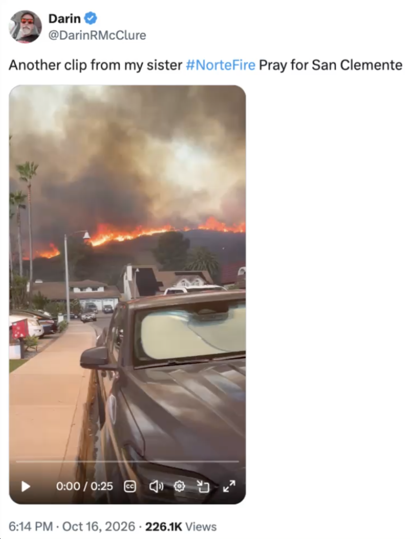
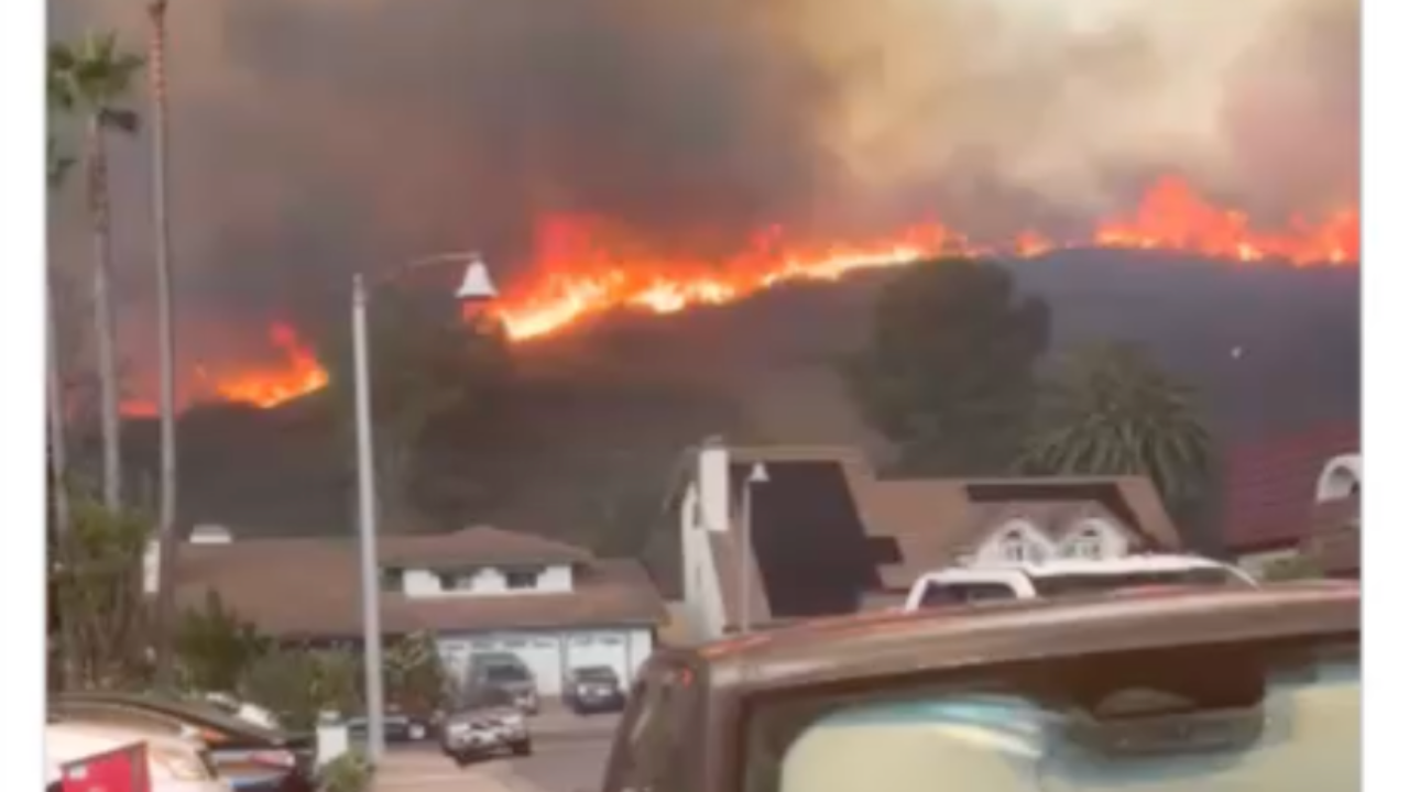
Another massive wildfire has just torn through a Southern California neighborhood, and multiple homes have burned to the ground. The Norte Fire broke out Friday in San Clemente, raced into San Juan Capistrano, and forced evacuation orders as flames jumped from one side of the neighborhood to the other.
At the same time, Southern California Edison is cutting power to tens of thousands of customers, red flag warnings are stretched across the region through the weekend, and new fires keep popping up faster than crews can get to them. Here is what we know right now.
Watch the full breakdown on YouTube: Something TERRIFYING just Happened..... Please Prepare Yourself
Norte Fire burns homes in San Clemente and San Juan Capistrano
The Norte Fire ignited around 11:30 a.m. Friday, October 16, near Portico Del Norte in San Clemente, according to Cal Fire, and it quickly pushed into residential streets. Within hours it had grown to roughly 465 acres with 0% containment as of Friday night.
Video and photos coming out of the area are devastating. These are very nice homes, and they are burning down. Fire officials say at least six homes have been damaged or destroyed. Footage posted by residents shows the fire reaching houses as people were still nearby, and aerial shots show homes burning on both sides of the neighborhood at once. It is wild how fast this thing moved.
Evacuation orders were issued for San Juan Capistrano Zones 4, 5 and 10 and San Clemente Zones 12 and 13. Shelters opened at the San Juan Capistrano Community Center and the San Clemente Community Center. If you are anywhere near this fire, check your zone and follow official orders from the Orange County Fire Authority.
Smoke is blowing into Dana Point
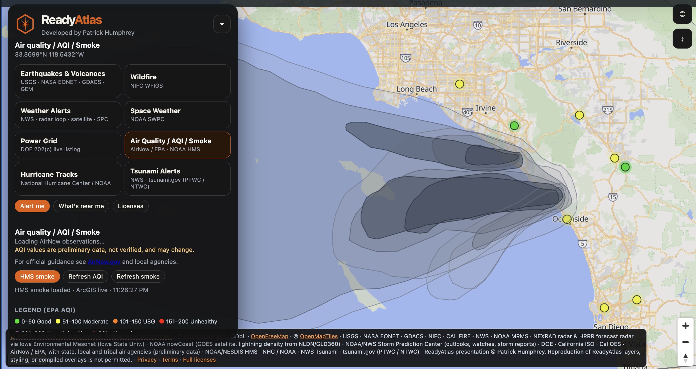
On the ReadyAtlas smoke map, there is a TON of smoke over this region right now, and it is blowing west toward Dana Point. Air quality officials warned that smoke from the Norte Fire would push air quality to levels unhealthy for sensitive groups in parts of South Orange County, including San Clemente, Dana Point, San Juan Capistrano and Laguna Niguel, into Saturday morning.
This stretch of the California coast has been getting HAMMERED. Dana Point has already been dealing with homes being red-tagged and damaged by heavy waves pounding the coastline over the past month. Now it is fire and smoke on top of that.
Fires are popping up everywhere: Henderson, Scales and Bryson
The Norte Fire did not happen in a vacuum. Several large fires have broken out across Southern California in just the past 24 to 48 hours:
- Henderson Fire - started Thursday inside Camp Pendleton near Oceanside and has burned about 2,080 acres.
- Scales Fire - a newer fire along Interstate 5 near San Onofre, held at around 20 acres, but it added even more smoke and briefly shut down the freeway.
- Bryson Fire - burning in the mountains near Encinal Canyon in Malibu, in Los Angeles County, threatening some structures and forcing evacuations in a more rural area.
When this many fires pop up at once, it OVERWHELMS emergency services. Crews already had helicopters and water-dropping aircraft on the Henderson Fire, and then had to move aerial resources over to the Norte and Bryson fires. Resources get spread thin, and seconds count when a fire is running into neighborhoods.
Empty reservoirs and pulled insurance raise red flags
A lot of these areas were already in a tough spot. Insurers like State Farm have pulled back from many California fire zones, leaving homeowners with shaky coverage at best.
There is also concern about water. It has been pointed out that some of the same reservoirs that were empty during the Palisades Fire are still empty roughly 20 months later. That matters. When aircraft and crews have to travel an extra 10 minutes or more each way to refill, that is multiple water drops lost every shift. Having critical firefighting reservoirs sitting empty is a major red flag.
Over 100,000 SCE customers cut off or facing shutoffs
With wildfire risk this high, Southern California Edison has been running widespread Public Safety Power Shutoffs (PSPS). A regional red flag warning remains in effect through Saturday evening for the Los Angeles and Ventura County areas, including the mountains, and extending to the Santa Barbara mountains.
As of Friday morning, SCE figures showed 52,953 customers without power in Los Angeles County and 57,120 customers in Ventura County affected by or facing shutoffs. That is over 110,000 customers, which means HUNDREDS OF THOUSANDS of people. California OES's statewide outage tracker showed about 33,000 customers out at the time of the video, and that number will keep moving as power gets cut and restored once winds die down.
When these shutoffs hit, it is not just your house. Traffic lights go dark. Banks, gas stations and even some government buildings lose power. And if your internet goes down, you may not even get alerts about a fire near you. This is becoming the new normal in fire country, and there needs to be a better solution, like burying power lines in the highest-risk areas.
Red flag warnings stretch into Texas, Oklahoma, Arkansas and Louisiana
This is not just a California problem. Red flag warnings have also been issued for East Texas and parts of Oklahoma, Arkansas and Louisiana, with critical fire danger through Saturday morning. Forecasters are pointing to 30 mph gusts, relative humidity around 25%, and critically dry fuels. Any fire that starts there could spread rapidly.
Texas knows how bad this can get. Just a couple of months ago, the Ross Fire in North Texas burned more than 80,000 acres, tearing through ranches and farmland and even reaching a solar panel field. And the Southeast's fire season typically gets worse heading into winter. Georgia and Florida already saw large fires earlier this year with homes lost and evacuations ordered.
Track every fire with ReadyAtlas
Fires like the Norte Fire do not wait for the evening news. ReadyAtlas shows a fire the moment it pops up, then adds the fire perimeter as soon as mapping is released. Everything is in one place:
- Wildfires, fire perimeters and smoke maps
- Power grid alerts and outages
- NWS weather alerts
- Earthquakes and tsunami alerts
- Hurricane tracks
- Space weather
Set a watch area around your home and get notified when something new shows up near you.
Get ReadyAtlas now and stay ahead of the next fire, power shutoff or evacuation order.
Or sign up for email updates so you do not miss the next one.
What do you think is behind all these fires? Stay safe, stay prepared, stay stocked up, and stay ready. Big blessings to you and your family.
Watch the full video: Something TERRIFYING just Happened..... Please Prepare Yourself
Get Every Alert in One Place
ReadyAtlas puts all of these on one live map:
🌋 Earthquakes & Volcanoes
🔥 Wildfires & Fire Perimeters
⛈️ NWS Weather Alerts, Forecasts & Radar
🌀 Hurricane Tracks & Cones
🌊 Tsunami Warnings, Advisories & Watches
⚡ Power Grid Emergency Orders
☀️ Space Weather & Geomagnetic Storms
💨 Air Quality (AQI) & Wildfire Smoke
Set a watch area and get notified when something new pops up near you.
Stay connected with news and updates!
Join our mailing list to receive the latest news and updates from our team.
Don't worry, your information will not be shared.
We hate SPAM. We will never sell your information, for any reason.